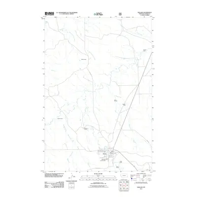
2011 Map of Ekalaka
USGS Topo · Published 2011About this map
Ekalaka serves as the focal point of this Carter County landscape, where the town's grid meets the surrounding drainages of Russell Creek and Dugan Creek. The settlement's essential civic infrastructure is well-defined, including the Ekalaka Vol Fire Dept, the Ekalaka Post Office, and the Carter County Fairgrounds on the northern edge of town. For genealogists and local historians, the Independent Order of Odd Fellows Cemetery is a significant landmark situated just south of the main residential streets like Williams St and Park Ave. The terrain is characterized by numerous draws and buttes, such as Wilder Butte and Flasted Draw, showing the intricate erosion patterns leading toward East Fork O'Fallon Creek. Two small airfields, Castleberry Airport and Ekalaka Airport, anchor the north and south, reflecting the logistical needs of this southeastern Montana community.
Find a feature on this map
30 named features on this map. Tap any name to fly to it.
Don’t see what you’re looking for? This feature index may not catch every label — zoom into the map to look around manually.
Map Details
Editions of this 2011 Ekalaka Map
This is the sole edition of this map. No revisions or reprints were ever made.
Other maps of this area

1953 · Miles City
USGS Topo · 1:250,000

1954 · Ekalaka
USGS Topo · 1:250,000

1956 · Ekalaka
USGS Topo · 1:250,000

1957 · Miles City
USGS Topo · 1:250,000

1958 · Miles City
USGS Topo · 1:250,000

1958 · Ekalaka
USGS Topo · 1:250,000

1965 · Ekalaka
USGS Topo · 1:250,000

1979 · Beaver Flats South
USGS Topo · 1:24,000

1979 · Ekalaka
USGS Topo · 1:24,000

1979 · Beaver Flats North
USGS Topo · 1:24,000