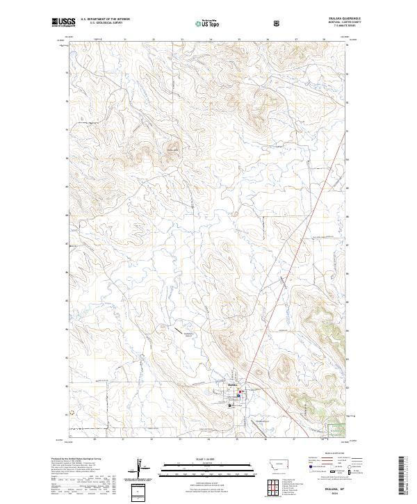
2024 Map of Ekalaka
USGS Topo · Published 2024About this map
Ekalaka serves as the focal point of this Carter County landscape, where the Carter County Courthouse stands as a central landmark of local governance. The surrounding terrain is defined by high points like Wilder Butte and the rising Ekalaka Hills to the southeast, which transition into the protected lands of the Custer National Forest. This modern record reveals how transportation routes like the Miles City Cutoff and Plevna Rd navigate the prairie topography, following the natural drainage of East Fork O'Fallon Creek and Heggen Creek. Local aviation is represented by two separate facilities, the Ekalaka Airport and Castleberry Airport, while the Beaver Lodge Cem provides a point of genealogical interest at the town’s southern edge. The map captures the specialized agricultural and ranching infrastructure of eastern Montana, from the named draws like Flagsted Draw to the grid-patterned township roads that segment the cattle country.
Find a feature on this map
34 named features on this map. Tap any name to fly to it.
Don’t see what you’re looking for? This feature index may not catch every label — zoom into the map to look around manually.
Map Details
Editions of this 2024 Ekalaka Map
This is the sole edition of this map. No revisions or reprints were ever made.
Other maps of this area

1953 · Miles City
USGS Topo · 1:250,000

1954 · Ekalaka
USGS Topo · 1:250,000

1956 · Ekalaka
USGS Topo · 1:250,000

1957 · Miles City
USGS Topo · 1:250,000

1958 · Miles City
USGS Topo · 1:250,000

1958 · Ekalaka
USGS Topo · 1:250,000

1965 · Ekalaka
USGS Topo · 1:250,000

1979 · Beaver Flats South
USGS Topo · 1:24,000

1979 · Ekalaka
USGS Topo · 1:24,000

1979 · Beaver Flats North
USGS Topo · 1:24,000