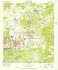
1955 Map of El Cajon
USGS Topo · Published 1956About this map
The San Diego River valley and surrounding foothills define this mid-1950s landscape, showing a transition from agricultural land to suburban expansion. The city of El Cajon serves as a central hub, flanked by the residential growth of Bostonia and La Mesa. Notable institutional sites like the Edgemoor County Farm and Gillespie Field occupy large tracts of land, while the San Diego and Arizona Eastern RR provides the primary rail link through the valley. Unique local operations such as the Maniscaleos Cactus Farm and the County Fairgrounds near Lakeside reflect the area's rural roots. Topographical markers like Mt Helix and Eucalyptus Hills frame the residential developments, which are supported by numerous neighborhood schools including Cajon Valley Jr High Sch and Grossmont High Sch. Religious and educational institutions are well-represented by St Francis Seminary and the Immaculate Heart Seminary located along the eastern slopes.
Find a feature on this map
64 named features on this map. Tap any name to fly to it.
Don’t see what you’re looking for? This feature index may not catch every label — zoom into the map to look around manually.
Map Details
Editions of this 1955 El Cajon Map
2 editions found
Other maps of this area

1893 · El Cajon
USGS Topo · 1:62,500

1901 · Elcajon
USGS Topo · 1:62,500

1903 · Cuyamaca
USGS Topo · 1:125,000

1903 · La Jolla
USGS Topo · 1:62,500

1903 · Elcajon
USGS Topo · 1:62,500

1904 · San Diego
USGS Topo · 1:62,500

1904 · Southern California Sheet No. 2
USGS Topo · 1:250,000

1930 · La Jolla
USGS Topo · 1:62,500

1930 · San Diego
USGS Topo · 1:62,500

1939 · El Cajon
USGS Topo · 1:62,500