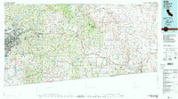
1979 Map of El Cajon
USGS Topo · Published 1979About this map
The San Diego & Arizona Eastern RR winds through the diverse terrain of eastern San Diego County, marking a vital transit corridor between the Pacific coast and the desert interior in the late 1970s. This survey illustrates a landscape defined by significant elevation changes, from the coastal foothills of Santee and El Cajon to the high Laguna Mountains and the arid reaches of the Yuha Desert. The southern boundary is defined by the international border with Mexico, where the remote settlements of Jacumba and Tecate serve as gatekeepers to the high desert passes.
Find a feature on this map
124 named features on this map. Tap any name to fly to it.
Don’t see what you’re looking for? This feature index may not catch every label — zoom into the map to look around manually.
Map Details
Editions of this 1979 El Cajon Map
2 editions found
Other maps of this area

1893 · El Cajon
USGS Topo · 1:62,500

1893 · Escondido
USGS Topo · 1:62,500

1901 · Elcajon
USGS Topo · 1:62,500

1901 · Escondido
USGS Topo · 1:62,500

1901 · San Luis Rey
USGS Topo · 1:125,000

1903 · Cuyamaca
USGS Topo · 1:125,000

1903 · La Jolla
USGS Topo · 1:62,500

1903 · Elcajon
USGS Topo · 1:62,500

1903 · Ramona
USGS Topo · 1:125,000

1904 · San Diego
USGS Topo · 1:62,500