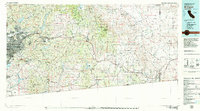
1979 Map of El Cajon
USGS Topo · Published 1979About this map
El Cajon and the urbanized western edge of San Diego County give way to the complex mountain and desert landscapes of southern California in the late 1970s. This survey documents the transitional zone from the suburban density of La Mesa and Spring Valley to the protected wilderness of Cleveland National Forest and Anza-Borrego Desert State Park. The map captures a significant network of water infrastructure, including San Vicente Reservoir, El Capitan Reservoir, and Lake Morena, which remain vital to the region's development.
Find a feature on this map
104 named features on this map. Tap any name to fly to it.
Don’t see what you’re looking for? This feature index may not catch every label — zoom into the map to look around manually.
Map Details
Editions of this 1979 El Cajon Map
2 editions found
Other maps of this area

1893 · El Cajon
USGS Topo · 1:62,500

1893 · Escondido
USGS Topo · 1:62,500

1901 · Elcajon
USGS Topo · 1:62,500

1901 · Escondido
USGS Topo · 1:62,500

1901 · San Luis Rey
USGS Topo · 1:125,000

1903 · Cuyamaca
USGS Topo · 1:125,000

1903 · La Jolla
USGS Topo · 1:62,500

1903 · Elcajon
USGS Topo · 1:62,500

1903 · Ramona
USGS Topo · 1:125,000

1904 · San Diego
USGS Topo · 1:62,500