
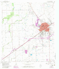
1965 Map of El Campo
USGS Topo · Published 1967About this map
El Campo serves as the bustling hub of this mid-1960s agricultural and industrial landscape, where the Southern Pacific railroad cuts a diagonal line through the town's dense grid. The map reveals a community heavily invested in education and health, featuring the Nightingale Hosp, the El Campo Opportunity Sch, and numerous neighborhood schools like North Side Sch and South Side Sch. To the southwest, the small settlement of Hillje sits along the rail line, anchored by St Andrews Ch.
Find a feature on this map
42 named features on this map. Tap any name to fly to it.
Don’t see what you’re looking for? This feature index may not catch every label — zoom into the map to look around manually.
Map Details
Editions of this 1965 El Campo Map
2 editions found
Other maps of this area

1951 · Danevang
USGS Topo · 1:24,000

1952 · Pierce
USGS Topo · 1:24,000

1953 · Glen Flora
USGS Topo · 1:24,000

1953 · Seguin
USGS Topo · 1:250,000

1958 · Seguin
USGS Topo · 1:250,000

1960 · New Taiton
USGS Topo · 1:24,000

1965 · Gobbler Creek
USGS Topo · 1:24,000
1965 · El Campo SE
USGS Topo · 1:24,000
1965 · Hahn
USGS Topo · 1:24,000
1965 · Louise
USGS Topo · 1:24,000