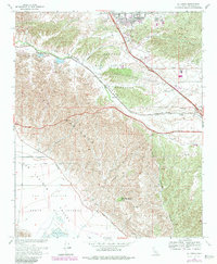
1967 Map of El Casco
USGS Topo · Published 1984About this map
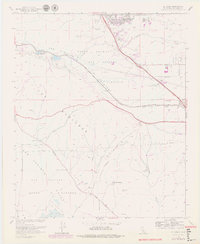
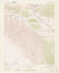
San Timoteo Canyon serves as a primary corridor for the Southern Pacific railroad, cutting through a landscape defined by the erosive ridges of The Badlands and the open San Jacinto Valley. In this mid-century period, the map documents a shift from traditional rural uses toward suburban development near Calimesa and Yucaipa. Historical landmarks like Eden Hot Springs at the foot of Mt Eden reflect the area's legacy as a destination, while the small settlement at El Casco and its nearby El Casco Lake anchor the northwestern portion of the canyon. Significant land divisions, including the Tract Between San Jacinto and San Gorgonio and various Grant Boundaries, illustrate the complex transition from historic rancho holdings to modernized property lines in Riverside County.
Find a feature on this map
22 named features on this map. Tap any name to fly to it.
Don’t see what you’re looking for? This feature index may not catch every label — zoom into the map to look around manually.
Map Details
Editions of this 1967 El Casco Map
6 editions found
Other maps of this area

1899 · Redlands
USGS Topo · 1:62,500

1901 · Southern California Sheet No. 1
USGS Topo · 1:250,000

1901 · San Jacinto
USGS Topo · 1:125,000

1901 · Redlands
USGS Topo · 1:62,500

1901 · Elsinore
USGS Topo · 1:125,000

1902 · San Gorgonio
USGS Topo · 1:125,000

1904 · Southern California Sheet No. 1
USGS Topo · 1:250,000

1942 · Banning
USGS Topo · 1:62,500

1942 · Perris
USGS Topo · 1:62,500

1943 · Perris
USGS Topo · 1:62,500