
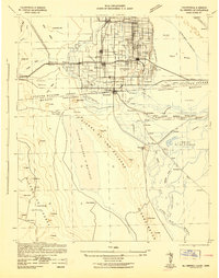
1942 Map of El Centro
USGS Topo · Published 1942About this map
The Imperial Valley and the expansive desert terrain of the United States Mexico border region are documented here during the early 1940s. Irrigation systems are central to this landscape, with the All American Canal and the Central Main Canal branching out to transform the arid floor into productive farmland. Major population centers like El Centro, Brawley, and Calexico are shown alongside smaller agricultural outposts and schools such as Acacia Sch and Jasper Sch. South of the border, the rugged Sierra De Los Cucapas and the vast Laguna Salada O' Macuala dominate the Baja California landscape.
Find a feature on this map
110 named features on this map. Tap any name to fly to it.
Don’t see what you’re looking for? This feature index may not catch every label — zoom into the map to look around manually.
Map Details
Editions of this 1942 El Centro Map
2 editions found
Other maps of this area

1903 · Yuma
USGS Topo · 1:125,000

1905 · Yuma
USGS Topo · 1:125,000

1907 · Holtville
USGS Topo · 1:125,000

1915 · El Centro
USGS Topo · 1:125,000

1931 · Vallecito
USGS Topo · 1:125,000

1931 · Carrizo
USGS Topo · 1:125,000

1939 · Jacumba
USGS Topo · 1:62,500

1940 · Brawley
USGS Topo · 1:62,500

1940 · Kane Spring
USGS Topo · 1:62,500

1940 · Iris
USGS Topo · 1:62,500