
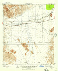
1961 Map of El Centro
USGS Topo · Published 1961About this map
The Imperial Valley dominates this 1961 landscape, revealing an intricate network of irrigation infrastructure including the All American Canal, Coachella Canal, and East Highline Canal. These water systems, alongside the New River and Alamo River, transformed the desert into a productive agricultural hub centered on El Centro, Brawley, and Calexico. The era is defined by massive military footprints, from the Yuma Test Station and Williams Bombing and Gunnery Range to the vast U.S. Naval Impact Range situated within the shifting Sand Hills. Beyond the fields, the map traces the Southern Pacific railroad lines and the route of U.S. 80, connecting isolated stops like Plaster City and Ogilby. Local history details include the Imperial County Tuberculosis Sanatorium and mining operations such as the Castle Dome Mine in the Castle Dome Mountains.
Find a feature on this map
72 named features on this map. Tap any name to fly to it.
Don’t see what you’re looking for? This feature index may not catch every label — zoom into the map to look around manually.
Map Details
Editions of this 1961 El Centro Map
This is the sole edition of this map. No revisions or reprints were ever made.
Other maps of this area

1903 · Yuma
USGS Topo · 1:125,000

1905 · Yuma
USGS Topo · 1:125,000

1907 · Holtville
USGS Topo · 1:125,000

1915 · El Centro
USGS Topo · 1:125,000

1926 · Fortuna
USGS Topo · 1:62,500
1926 · Wellton
USGS Topo · 1:62,500

1926 · Mohawk
USGS Topo · 1:62,500
1928 · Mohawk
USGS Topo · 1:62,500

1928 · Norton
USGS Topo · 1:62,500
1929 · Fortuna
USGS Topo · 1:62,500