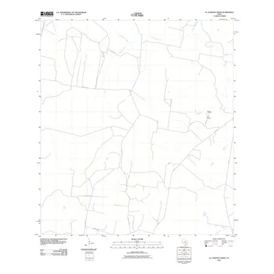
2010 Map of El Chapote Creek
USGS Topo · Published 2010About this map
El Chapote Creek and its seasonal tributaries define this brush-country landscape in South Texas, where ranching infrastructure and rural roads weave through the drainages of the Rio Grande basin. The 2010 survey reflects a territory of sprawling acreage and private landholdings, connected by a network of thoroughfares like San Julian Rd and FM 649. Small-scale family heritage is preserved at sites such as Elizondo Cemetery and Garcia Cemetery, which remain as fixed points of local history amidst the shifting riparian corridors of Del Puerto Creek and Saremente Creek. The map provides a clear look at the intersection of modern transportation routes, such as F M 3167, and the traditional creek-fed topography that has dictated the area's land use for generations.
Find a feature on this map
14 named features on this map. Tap any name to fly to it.
Don’t see what you’re looking for? This feature index may not catch every label — zoom into the map to look around manually.
Map Details
Editions of this 2010 El Chapote Creek Map
This is the sole edition of this map. No revisions or reprints were ever made.
Other maps of this area

1938 · Falcon
USGS Topo · 1:62,500

1938 · El Sauz
USGS Topo · 1:62,500

1949 · Mc Allen
USGS Topo · 1:250,000

1954 · McAllen
USGS Topo · 1:250,000

1956 · Escobares
USGS Topo · 1:62,500

1956 · Roma
USGS Topo · 1:62,500

1957 · Mc Allen
USGS Topo · 1:250,000

1962 · McAllen
USGS Topo · 1:250,000

1965 · Salineno
USGS Topo · 1:24,000

1965 · Lopeno
USGS Topo · 1:24,000