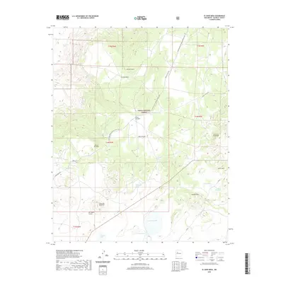
2020 Map of El Dado Mesa
USGS Topo · Published 2020About this map
High desert volcanic terrain and the towering landforms of Mesa Chivato define this portion of the Cibola National Forest. The geography is shaped by a series of mesas and canyons, including El Dado Mesa and the nearby Rincon del Dado, showcasing the complex topography of the Mount Taylor volcanic field. This landscape is a patchwork of arid highlands and critical water sources such as La Vera Spring and Ojo de las Yeguas.
Find a feature on this map
34 named features on this map. Tap any name to fly to it.
Don’t see what you’re looking for? This feature index may not catch every label — zoom into the map to look around manually.
Map Details
Editions of this 2020 El Dado Mesa Map
This is the sole edition of this map. No revisions or reprints were ever made.
Other maps of this area

1883 · Mt. Taylor
USGS Topo · 1:250,000

1886 · Mt. Taylor
USGS Topo · 1:250,000

1892 · Mt. Taylor
USGS Topo · 1:250,000

1899 · Mt. Taylor
USGS Topo · 1:250,000

1958 · Albuquerque
USGS Topo · 1:250,000

1961 · Marquez
USGS Topo · 1:24,000

1961 · El Dado
USGS Topo · 1:24,000

1961 · Cerro Parido
USGS Topo · 1:24,000

1961 · El Dado Mesa
USGS Topo · 1:24,000
1961 · Laguna Seca
USGS Topo · 1:24,000