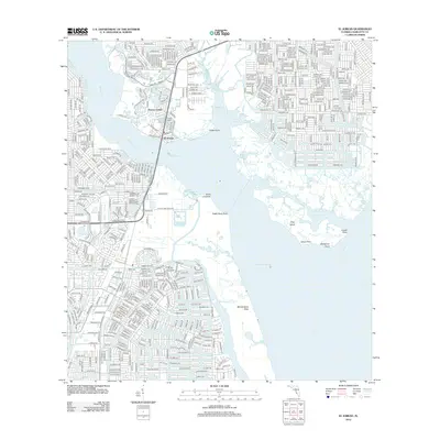
2012 Map of El Jobean
USGS Topo · Published 2012About this map
El Jobean and the surrounding waterfront communities of Charlotte Beach and Vizcaya Lakes define this coastal landscape at the confluence of the Myakka River and the Peace River. The geography is shaped by intricate waterways and tidal features such as Tippecanoe Bay, Muddy Cove, and the Myakka Cutoff, which separates the mainland from Hog Island. Residential development is dense in the western and northern sections, evidenced by tightly networked streets like Marathon Blvd and Edgewater Dr, while the eastern portion remains dominated by the sprawling wetlands of the McCall Sand Flats and named points like Ghost Point and Cattle Dock Point. A notable vertical landmark, Frizzell Tower, stands near the river crossing, punctuating a terrain primarily defined by the transition from suburban blocks to mangrove-lined shores such as Mangrove Point and Locat Point.
Find a feature on this map
48 named features on this map. Tap any name to fly to it.
Don’t see what you’re looking for? This feature index may not catch every label — zoom into the map to look around manually.
Map Details
Editions of this 2012 El Jobean Map
This is the sole edition of this map. No revisions or reprints were ever made.
Other maps of this area

1944 · Myakka River
USGS Topo · 1:31,680

1956 · Murdock
USGS Topo · 1:24,000

1956 · Murdock SE
USGS Topo · 1:24,000

1956 · Punta Gorda SE
USGS Topo · 1:24,000

1956 · Englewood
USGS Topo · 1:24,000

1956 · Tampa
USGS Topo · 1:250,000

1956 · Charlotte Harbor
USGS Topo · 1:250,000

1957 · El Jobean
USGS Topo · 1:24,000

1957 · Punta Gorda SW
USGS Topo · 1:24,000

1957 · Punta Gorda
USGS Topo · 1:24,000