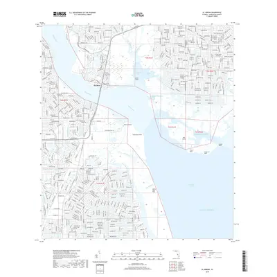
2018 Map of El Jobean
USGS Topo · Published 2018About this map
The El Jobean settlement occupies a strategic bend where the Myakka River opens into the broad expanse of Charlotte Harbor. This 2018 survey illustrates a complex coastal landscape defined by intricate residential developments and tidal waterways. To the west, the circular planning of the Rotunda River area contrasts with the more traditional grid of El Jobean, while the eastern shoreline remains dominated by natural features like Tippecanoe Bay and Muddy Cove.
Find a feature on this map
198 named features on this map. Tap any name to fly to it.
Don’t see what you’re looking for? This feature index may not catch every label — zoom into the map to look around manually.
Map Details
Editions of this 2018 El Jobean Map
This is the sole edition of this map. No revisions or reprints were ever made.
Other maps of this area

1944 · Myakka River
USGS Topo · 1:31,680

1956 · Murdock
USGS Topo · 1:24,000

1956 · Murdock SE
USGS Topo · 1:24,000

1956 · Punta Gorda SE
USGS Topo · 1:24,000

1956 · Englewood
USGS Topo · 1:24,000

1956 · Tampa
USGS Topo · 1:250,000

1956 · Charlotte Harbor
USGS Topo · 1:250,000

1957 · El Jobean
USGS Topo · 1:24,000

1957 · Punta Gorda SW
USGS Topo · 1:24,000

1957 · Punta Gorda
USGS Topo · 1:24,000