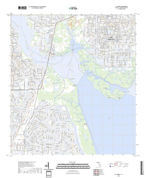
2024 Map of El Jobean
USGS Topo · Published 2024About this map
El Jobean and the southwestern edges of Port Charlotte occupy a landscape defined by the convergence of the Myakka River and Charlotte Harbor. The modern residential street networks are strikingly dense against the surrounding protected lands of the Charlotte Harbor Preserve State Park Trail, illustrating the balance between coastal development and environmental preservation. Along the waterfront, features like Cattle Dock Point and Point Lonesom suggest the area's maritime and ranching history before the era of modern subdivision.
Find a feature on this map
35 named features on this map. Tap any name to fly to it.
Don’t see what you’re looking for? This feature index may not catch every label — zoom into the map to look around manually.
Map Details
Editions of this 2024 El Jobean Map
This is the sole edition of this map. No revisions or reprints were ever made.
Other maps of this area

1944 · Myakka River
USGS Topo · 1:31,680

1956 · Murdock
USGS Topo · 1:24,000

1956 · Murdock SE
USGS Topo · 1:24,000

1956 · Punta Gorda SE
USGS Topo · 1:24,000

1956 · Englewood
USGS Topo · 1:24,000

1956 · Tampa
USGS Topo · 1:250,000

1956 · Charlotte Harbor
USGS Topo · 1:250,000

1957 · El Jobean
USGS Topo · 1:24,000

1957 · Punta Gorda SW
USGS Topo · 1:24,000

1957 · Punta Gorda
USGS Topo · 1:24,000