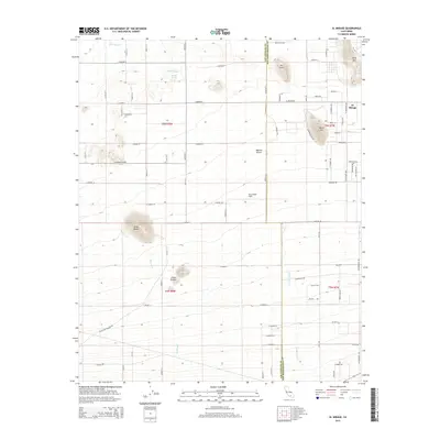
2015 Map of El Mirage
USGS Topo · Published 2015About this map
The Mojave Desert terrain defines this section of the High Desert along the Los Angeles and San Bernardino county line. The settlement of El Mirage sits at the northeastern edge of a vast, flat expanse, characterized by a strictly organized grid of roads like El Mirage Rd and E Palmdale Blvd that cut through the desert floor. This modern survey illustrates the persistent tension between human infrastructure and the arid landscape, where desert washes like Mescal Cr and Le Montaine Cr descend toward the basin.
Find a feature on this map
48 named features on this map. Tap any name to fly to it.
Don’t see what you’re looking for? This feature index may not catch every label — zoom into the map to look around manually.
Map Details
Editions of this 2015 El Mirage Map
This is the sole edition of this map. No revisions or reprints were ever made.
Other maps of this area

1901 · Southern California Sheet No. 1
USGS Topo · 1:250,000

1903 · Rock Creek
USGS Topo · 1:62,500

1903 · San Antonio
USGS Topo · 1:62,500

1904 · Southern California Sheet No. 1
USGS Topo · 1:250,000

1930 · Black Butte
USGS Topo · 1:24,000

1930 · El Mirage
USGS Topo · 1:24,000

1930 · Angle
USGS Topo · 1:24,000

1930 · Wilsona
USGS Topo · 1:24,000

1932 · Angle
USGS Topo · 1:24,000

1933 · El Mirage
USGS Topo · 1:24,000