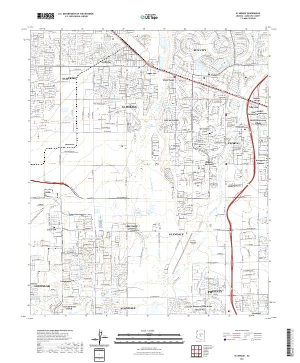
2021 Map of El Mirage
USGS Topo · Published 2021About this map
El Mirage and the surrounding West Valley communities are depicted here in a period of significant suburban expansion and complex land use. The residential grids of Sun City and Youngtown contrast with the large industrial and agricultural tracts near Bumstead and the Agua Fria River. This map is particularly notable for its detailed recording of several columbariums and memorial gardens, such as the Garden of Memories Columbarium and Scattering Garden in Peoria and the Lakeview United Methodist Church Columbarium.
Find a feature on this map
162 named features on this map. Tap any name to fly to it.
Don’t see what you’re looking for? This feature index may not catch every label — zoom into the map to look around manually.
Map Details
Editions of this 2021 El Mirage Map
This is the sole edition of this map. No revisions or reprints were ever made.
Other maps of this area

1912 · Phoenix
USGS Topo · 1:62,500

1914 · Phoenix
USGS Topo · 1:62,500

1946 · Avondale
USGS Topo · 1:62,500

1948 · Cashion
USGS Topo · 1:62,500

1952 · Fowler
USGS Topo · 1:24,000

1952 · Phoenix
USGS Topo · 1:62,500

1954 · Phoenix
USGS Topo · 1:250,000

1957 · Phoenix
USGS Topo · 1:250,000

1957 · Perryville
USGS Topo · 1:24,000

1957 · Calderwood Butte
USGS Topo · 1:24,000