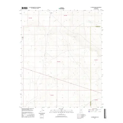
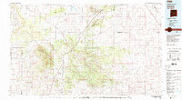
2017 Map of El Morro Ranch
USGS Topo · Published 2017About this map
El Morro Ranch and Sotano Blanco anchor this high-plains landscape along the border of Guadalupe and De Baca counties. The terrain is defined by the drainage of Salado Cr in the northeast and a vast network of section lines typical of the Public Land Survey System in New Mexico. Local infrastructure is minimal, consisting primarily of rural routes such as Co Rd 3f and Co Rd 3h that navigate the varied elevations. The map reveals the sparse, ranch-based economy of the region, where wide-open spaces are segmented by township and range divisions like t4n r19e, illustrating the persistent layout of western land management into the 21st century.
Find a feature on this map
12 named features on this map. Tap any name to fly to it.
Don’t see what you’re looking for? This feature index may not catch every label — zoom into the map to look around manually.
Map Details
Editions of this 2017 El Morro Ranch Map
This is the sole edition of this map. No revisions or reprints were ever made.
Other maps of this area

1954 · Fort Sumner
USGS Topo · 1:250,000

1958 · Fort Sumner
USGS Topo · 1:250,000
1978 · El Morro Ranch SE
USGS Topo · 1:24,000
1978 · El Morro Ranch
USGS Topo · 1:24,000
1978 · Laguna De Los Terreros
USGS Topo · 1:24,000
1978 · El Morro Ranch NW
USGS Topo · 1:24,000
1978 · Long Draw
USGS Topo · 1:24,000
1978 · Burro Lake
USGS Topo · 1:24,000
1979 · Fort Sumner
USGS Topo · 1:100,000
1980 · Corona
USGS Topo · 1:100,000