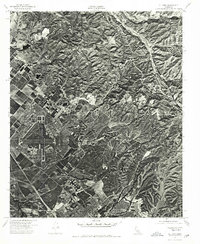
1974 Map of El Toro
USGS Topo · Published 1975About this map
El Toro Marine Corps Air Station dominates the western half of this orthophotoquad, showing the intricate layout of runways, hangars, and taxiways in high-resolution detail. The imagery, captured by the Geological Survey and the Orange County Board of Supervisors, reveals a transition from heavy military and agricultural land use into the rising elevation of the eastern foothills. While the base occupies the flatlands, the eastern portion of the sheet is defined by the sharp, rugged topography of a prominent Ridge, where the land remains largely undeveloped. This 1974 perspective provides a clear view of the landscape's dual character, juxtaposing the precise geometry of the airfield and surrounding grid-patterned fields against the natural, irregular patterns of the higher terrain.
Find a feature on this map
2 named features on this map. Tap any name to fly to it.
Don’t see what you’re looking for? This feature index may not catch every label — zoom into the map to look around manually.
Map Details
Editions of this 1974 El Toro Map
This is the sole edition of this map. No revisions or reprints were ever made.
Other maps of this area

1896 · Santa Ana
USGS Topo · 1:62,500

1896 · Anaheim
USGS Topo · 1:62,500

1898 · Anaheim
USGS Topo · 1:62,500

1901 · Southern California Sheet No. 1
USGS Topo · 1:250,000

1901 · Santa Ana
USGS Topo · 1:62,500

1901 · Anaheim
USGS Topo · 1:62,500

1902 · Corona
USGS Topo · 1:125,000

1904 · Southern California Sheet No. 1
USGS Topo · 1:250,000

1932 · Orange
USGS Topo · 1:31,680

1932 · Tustin
USGS Topo · 1:31,680