1948 Map of El Wood
USGS Topo · Published 1948About this map
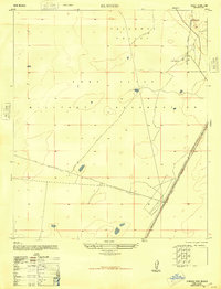
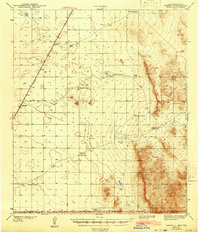
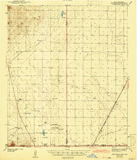
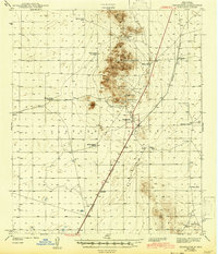
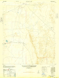
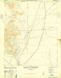
Fort Bliss Military Reservation dominates this stretch of the Tularosa Valley, reflecting a landscape increasingly defined by Cold War-era defense requirements. The map, derived from U.S. Army Air Force photography taken during the war, illustrates the intersection of desert ranching infrastructure and military expansion. Along the eastern edge, the Southern Pacific railroad runs adjacent to the small settlement of Elwood, providing a critical transportation link through the arid basin. Family-named landmarks such as McNew South Tank suggest the area's grazing history before its inclusion in the military reservation. The terrain is characterized by broad alkali flats and isolated rises like Rattlesnake Hill, showing the land as it appeared just as it was being repurposed for wide-scale military training and testing.
Find a feature on this map
7 named features on this map. Tap any name to fly to it.
Don’t see what you’re looking for? This feature index may not catch every label — zoom into the map to look around manually.
Map Details
Editions of this 1948 El Wood Map
This is the sole edition of this map. No revisions or reprints were ever made.
Other maps of this area
1940 · Orogrande
USGS Topo · 1:62,500

1940 · Newman
USGS Topo · 1:62,500
1941 · Desert
USGS Topo · 1:62,500
1943 · Parker Lake
USGS Topo · 1:62,500
1943 · Desert
USGS Topo · 1:62,500
1943 · Newman
USGS Topo · 1:62,500
1943 · Orogrande
USGS Topo · 1:62,500
1947 · Desert NE
USGS Topo · 1:24,000
1947 · Orogrande North
USGS Topo · 1:24,000
1948 · Desert
USGS Topo · 1:24,000