
1947 Map of Desert NE
USGS Topo · Published 1947About this map
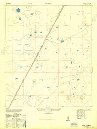
The Hueco Mountains dominate the southeastern portion of this 1947 Army Map Service survey, providing a sharp vertical contrast to the desert floor. This landscape reflects the essential ranching infrastructure of mid-century Otero County, where water management was the primary concern for survival and industry. Strategically placed catchment features like Alvarado Tank No 2, Borrego Tank, and South Tank appear alongside the South Well and a solitary Windmill, marking the few reliable points of activity in an otherwise arid expanse. Small-scale human presence is further evidenced by a Corral and a School Tank, suggesting a coordinated effort to support livestock and perhaps local families in the shadow of the mountains. The map’s focus on water sources and terrain highlights the reliance on primitive infrastructure before later developments altered the desert's character.
Find a feature on this map
8 named features on this map. Tap any name to fly to it.
Don’t see what you’re looking for? This feature index may not catch every label — zoom into the map to look around manually.
Map Details
Editions of this 1947 Desert NE Map
This is the sole edition of this map. No revisions or reprints were ever made.
Other maps of this area

1940 · Bassett Lake
USGS Topo · 1:62,500

1940 · Orogrande
USGS Topo · 1:62,500

1941 · Desert
USGS Topo · 1:62,500

1943 · Pendejo Wash
USGS Topo · 1:62,500

1943 · Desert
USGS Topo · 1:62,500

1943 · Bassett Lake
USGS Topo · 1:62,500

1943 · Orogrande
USGS Topo · 1:62,500

1948 · El Wood
USGS Topo · 1:24,000
1948 · Desert
USGS Topo · 1:24,000
1948 · Orogrande South
USGS Topo · 1:24,000