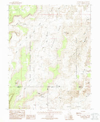
1988 Map of Elaterite Basin
USGS Topo · Published 1988About this map
Elaterite Basin and the surrounding high desert canyonlands are captured here at a time when access to this remote corner of Wayne Co and Garfield Co remained largely primitive. The landscape is defined by the sharp transition between the Orange Cliffs to the west and the intricate labyrinth of The Maze to the east. A complex network of drainage systems, including Horse Canyon and Big Water Canyon, illustrates the erosional forces that shaped the Land of Standing Rocks.
Find a feature on this map
36 named features on this map. Tap any name to fly to it.
Don’t see what you’re looking for? This feature index may not catch every label — zoom into the map to look around manually.
Map Details
Editions of this 1988 Elaterite Basin Map
2 editions found
Other maps of this area

1885 · San Rafael
USGS Topo · 1:250,000

1885 · La Sal
USGS Topo · 1:250,000

1951 · Upheaval Dome
USGS Topo · 1:62,500

1952 · Carlisle 2 SW
USGS Topo · 1:24,000

1953 · Carlisle 3 NW
USGS Topo · 1:24,000

1953 · Orange Cliffs 1 SE
USGS Topo · 1:24,000

1953 · Orange Cliffs 4 NW
USGS Topo · 1:24,000

1953 · Orange Cliffs 4 NE
USGS Topo · 1:24,000

1953 · Orange Cliffs 4 SW
USGS Topo · 1:24,000

1953 · The Spur
USGS Topo · 1:62,500