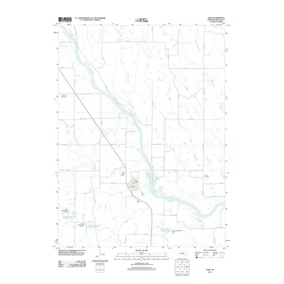
2011 Map of Elba
USGS Topo · Published 2011About this map
Elba serves as the central hub of this Nebraska landscape, situated along the meandering course of the North Loup River. The area is defined by a grid of rural roads and numerous waterways, including Moffet Creek, Munson Creek, and Auger Creek, which drain the surrounding agricultural lands. For genealogists and local historians, the map identifies several distinct burial grounds scattered across the township, including Saint Joseph Cemetery, Cotesfield Cemetery, Elba Cemetery, and Fairdale Cemetery. The town center includes the Elba Post Office, providing a clear point of reference for the community's civic life. Infrastructure improvements are evident through specialized water management features like Channel Block Reservoir 1-2 and various grade stabilization dams, while the presence of the Deadwood Trl hints at the historic transit routes that shaped the region's development. This survey provides a precise look at the rural Nebraska homestead and drainage patterns in the early 21st century.
Find a feature on this map
39 named features on this map. Tap any name to fly to it.
Don’t see what you’re looking for? This feature index may not catch every label — zoom into the map to look around manually.
Map Details
Editions of this 2011 Elba Map
This is the sole edition of this map. No revisions or reprints were ever made.
Other maps of this area

1899 · Loup
USGS Topo · 1:125,000

1899 · St. Paul
USGS Topo · 1:125,000

1953 · Cotesfield
USGS Topo · 1:24,000

1953 · Scotia NE
USGS Topo · 1:24,000

1953 · Scotia
USGS Topo · 1:24,000

1953 · Farwell
USGS Topo · 1:24,000

1953 · Nysted
USGS Topo · 1:24,000

1953 · Elba
USGS Topo · 1:24,000

1954 · Wolbach
USGS Topo · 1:24,000

1955 · Broken Bow
USGS Topo · 1:250,000