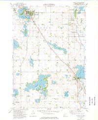
1973 Map of Elbow Lake
USGS Topo · Published 1975About this map
Glacial geology defines the landscape around Elbow Lake and Barrett, where a dense network of water bodies includes Worm Lake, Long Lake, and the expansive Cormorant Lake. The area reflects a well-established agricultural and civic structure in the early 1970s, evidenced by numerous rural burial grounds such as Ness Cem, Union Cem, and Fridhem Cem that serve as vital links for local genealogy.
Find a feature on this map
42 named features on this map. Tap any name to fly to it.
Don’t see what you’re looking for? This feature index may not catch every label — zoom into the map to look around manually.
Map Details
Editions of this 1973 Elbow Lake Map
This is the sole edition of this map. No revisions or reprints were ever made.
Other maps of this area

1910 · Wendell
USGS Topo · 1:62,500

1911 · Barrett
USGS Topo · 1:62,500

1911 · Herman
USGS Topo · 1:62,500

1913 · Ashby
USGS Topo · 1:62,500

1913 · Wendell
USGS Topo · 1:62,500

1953 · Milbank
USGS Topo · 1:250,000

1953 · Fargo
USGS Topo · 1:250,000

1953 · Brainerd
USGS Topo · 1:250,000

1953 · Saint Cloud
USGS Topo · 1:250,000

1956 · Fargo
USGS Topo · 1:250,000