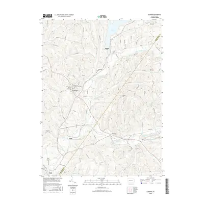
2016 Map of Elderton
USGS Topo · Published 2016About this map
Elderton and its neighboring rural townships are defined by a complex network of ridges and winding waterways along the border of Armstrong and Indiana Counties. The landscape is anchored by the large Keystone Lake to the north and the meandering path of Crooked Creek which flows past the settlement of Idaho. For those researching local families, the map identifies several significant burial grounds, including the Montgomery Family Cem and the South Bend Cem, alongside central congregational sites like the Elderton Presbyterian Church. The settlement pattern follows the contours of the land, with small communities like Shelocta, Gastown, and Advance connected by a web of named secondary roads such as Cessna Run Rd and Barks Hill Rd. The prominence of Russell Hill and the numerous named runs, such as Cheese-Run and Anthony Run, illustrate the deeply dissected topography that has influenced the development of this Pennsylvania countryside.
Find a feature on this map
97 named features on this map. Tap any name to fly to it.
Don’t see what you’re looking for? This feature index may not catch every label — zoom into the map to look around manually.
Map Details
Editions of this 2016 Elderton Map
This is the sole edition of this map. No revisions or reprints were ever made.
Other maps of this area

1901 · Rural Valley
USGS Topo · 1:62,500

1902 · Indiana
USGS Topo · 1:62,500

1902 · Elders Ridge
USGS Topo · 1:62,500

1903 · Rural Valley
USGS Topo · 1:62,500

1904 · Elders Ridge
USGS Topo · 1:62,500

1909 · Smicksburg
USGS Topo · 1:62,500

1938 · Smicksburg
USGS Topo · 1:62,500

1939 · Smicksburg
USGS Topo · 1:62,500

1953 · Pittsburgh
USGS Topo · 1:250,000

1954 · Pittsburgh
USGS Topo · 1:250,000