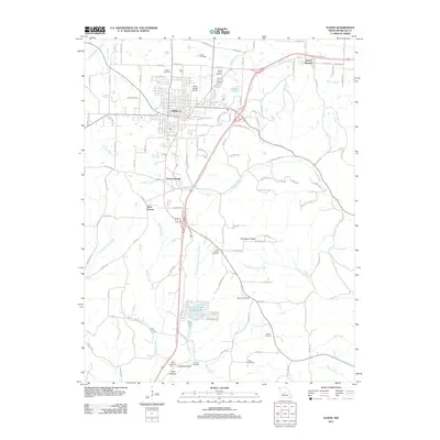
2011 Map of Eldon
USGS Topo · Published 2011About this map
The city of Eldon serves as the central hub of this Miller County landscape, characterized by a transition from organized residential blocks to the winding creek valleys and ridges of the surrounding countryside. A dense concentration of family and community burial grounds, including Salem Cemetery, Mount Vernon Cemetery, and Skinner Cemetery, provides significant data for genealogical research across the region. To the south, the terrain becomes more varied around Thompson Ridge, where the drainage of Little Saline Creek and the East Fork Little Gravois Creek shapes the local geography.
Find a feature on this map
61 named features on this map. Tap any name to fly to it.
Don’t see what you’re looking for? This feature index may not catch every label — zoom into the map to look around manually.
Map Details
Editions of this 2011 Eldon Map
This is the sole edition of this map. No revisions or reprints were ever made.
Other maps of this area

1888 · Versailles
USGS Topo · 1:125,000

1888 · Tuscumbia
USGS Topo · 1:125,000

1893 · Versailles
USGS Topo · 1:125,000

1894 · Tuscumbia
USGS Topo · 1:125,000

1904 · Eldon
USGS Topo · 1:62,500

1932 · Versailles No 4
USGS Topo · 1:48,000

1933 · Iberia
USGS Topo · 1:62,500

1934 · Lake Ozark
USGS Topo · 1:24,000

1934 · Bagnell
USGS Topo · 1:24,000

1935 · Rocky Mount
USGS Topo · 1:24,000