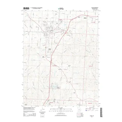
2015 Map of Eldon
USGS Topo · Published 2015About this map
Eldon serves as the primary hub of this Miller County landscape, showing a dense grid of streets including W Newton St and W High St that intersect near the central rail corridor. To the south and west, the terrain transitions into more scattered settlements like Aurora Springs and West Aurora, where the topography is defined by the winding paths of Saline Cr and Wrights Cr. Genealogy researchers will find an exceptional concentration of family and community burial sites, from the northern Salem Cemetery and Mount Pleasant Cemetery down to the Skinner Cemetery near the southern boundary. The presence of the Eldon Model Airpark and the residential area of Land of Lakes Incorporated highlights the modern land use patterns alongside traditional features like Thompson Ridge. This record preserves the location of many local landmarks before recent expansion, providing a clear view of the rural and suburban interface in central Missouri.
Find a feature on this map
147 named features on this map. Tap any name to fly to it.
Don’t see what you’re looking for? This feature index may not catch every label — zoom into the map to look around manually.
Map Details
Editions of this 2015 Eldon Map
This is the sole edition of this map. No revisions or reprints were ever made.
Other maps of this area

1888 · Versailles
USGS Topo · 1:125,000

1888 · Tuscumbia
USGS Topo · 1:125,000

1893 · Versailles
USGS Topo · 1:125,000

1894 · Tuscumbia
USGS Topo · 1:125,000

1904 · Eldon
USGS Topo · 1:62,500

1932 · Versailles No 4
USGS Topo · 1:48,000

1933 · Iberia
USGS Topo · 1:62,500

1934 · Lake Ozark
USGS Topo · 1:24,000

1934 · Bagnell
USGS Topo · 1:24,000

1935 · Rocky Mount
USGS Topo · 1:24,000