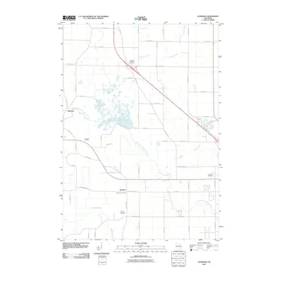
2010 Map of Eldorado
USGS Topo · Published 2010About this map
The West Branch Fond Du Lac River and its numerous tributaries, including Sevenmile Creek and Mosher Creek, define the drainage patterns across this Fond du Lac County landscape. The settlement of Eldorado serves as a local focal point near the river’s winding course, while Woodhull marks a smaller crossing to the south. The area is characterized by a high density of rural burial grounds, providing a significant resource for genealogical research with sites such as the Methodist Episcopal Cemetery, Saint Johns Cemetery, and the North Lamartine Cemetery scattered throughout the township. A grid of county roads and local routes, such as County Hwy-I and County Hwy-Rd N, connect these small communities and family landmarks. The map also reveals the headwaters of Van Dyne Creek in the north and the localized flow of Anderson Creek to the east, illustrating a landscape deeply tied to its small-scale water systems.
Find a feature on this map
56 named features on this map. Tap any name to fly to it.
Don’t see what you’re looking for? This feature index may not catch every label — zoom into the map to look around manually.
Map Details
Editions of this 2010 Eldorado Map
This is the sole edition of this map. No revisions or reprints were ever made.
Other maps of this area

1910 · Fond du Lac
USGS Topo · 1:62,500

1955 · Waupun
USGS Topo · 1:62,500

1955 · Campbellsport
USGS Topo · 1:62,500

1955 · Fond Du Lac
USGS Topo · 1:62,500

1955 · Fond Du Lac
USGS Topo · 1:24,000

1956 · Rosendale
USGS Topo · 1:62,500

1957 · Madison
USGS Topo · 1:250,000

1960 · Madison
USGS Topo · 1:250,000
1974 · Fahrney Point
USGS Topo · 1:24,000
1974 · Byron
USGS Topo · 1:24,000