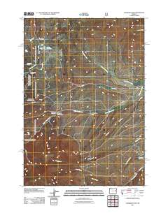
2011 Map of Eldorado Pass
USGS Topo · Published 2011About this map
Eldorado Pass stands as a central geographic feature in this part of Malheur County, where the high-elevation landscape is defined by its complex network of water management and livestock infrastructure. The drainage systems of North Willow Creek and Middle Willow Creek dominate the terrain, supported by localized features like Murray Dam and the associated Murray Reservoir. Evidence of ranching and early land use is found in labels such as HB Murray and the Ironside C and H Corrals near East Camp Creek.
Find a feature on this map
28 named features on this map. Tap any name to fly to it.
Don’t see what you’re looking for? This feature index may not catch every label — zoom into the map to look around manually.
Map Details
Editions of this 2011 Eldorado Pass Map
This is the sole edition of this map. No revisions or reprints were ever made.
Other maps of this area

1908 · Ironside Mountain
USGS Topo · 1:125,000

1955 · Baker
USGS Topo · 1:250,000

1955 · Canyon City
USGS Topo · 1:250,000

1959 · Baker
USGS Topo · 1:250,000

1959 · Canyon City
USGS Topo · 1:250,000

1964 · Ironside
USGS Topo · 1:62,500

1966 · Clover Creek Ranch
USGS Topo · 1:62,500

1970 · Castle Rock
USGS Topo · 1:62,500
1972 · Hereford
USGS Topo · 1:24,000
1972 · Unity
USGS Topo · 1:24,000