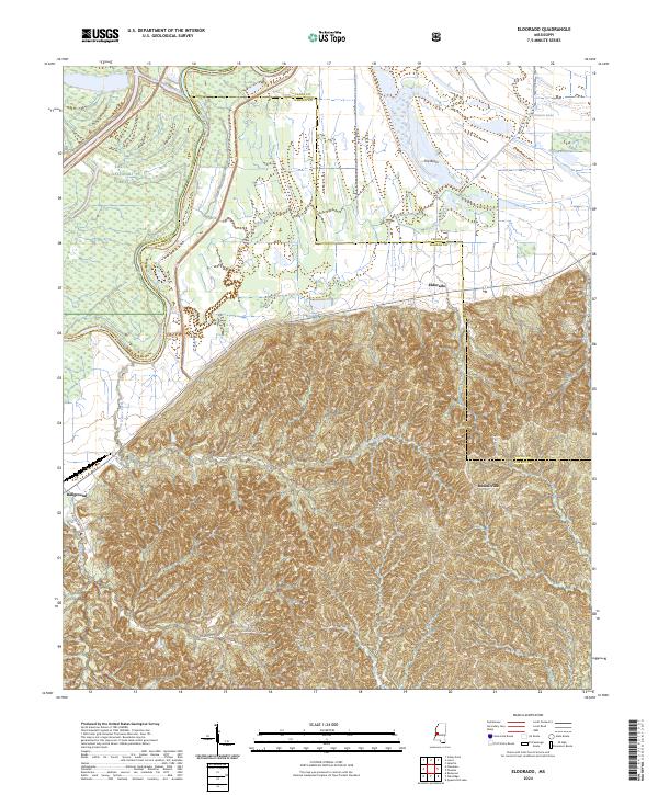
2024 Map of Eldorado
USGS Topo · Published 2024About this map
The Yazoo River and Little Sunflower River define the alluvial lowlands in this portion of Warren County, where the southern reaches of the Delta National Forest meet the rising bluffs. The landscape is sharply divided between the flat, water-carved terrain of The Basin and the intricately dissected hills to the south. Small settlements like Eldorado and Russellville sit at the transition between these two worlds, connected by a network of winding roads like Oak Ridge Rd and Russellville Rd that follow the natural topography of the ridges.
Find a feature on this map
26 named features on this map. Tap any name to fly to it.
Don’t see what you’re looking for? This feature index may not catch every label — zoom into the map to look around manually.
Map Details
Editions of this 2024 Eldorado Map
This is the sole edition of this map. No revisions or reprints were ever made.
Other maps of this area

1918 · Vicksburg
USGS Topo · 1:62,500

1938 · Edwards
USGS Topo · 1:62,500

1939 · Onward
USGS Topo · 1:62,500

1940 · Mechanicsburg
USGS Topo · 1:62,500

1941 · Vicksburg
USGS Topo · 1:62,500

1955 · Jackson
USGS Topo · 1:250,000

1961 · Jackson
USGS Topo · 1:250,000

1962 · Jackson
USGS Topo · 1:250,000

1962 · Redwood
USGS Topo · 1:24,000

1963 · Mechanicsburg
USGS Topo · 1:62,500