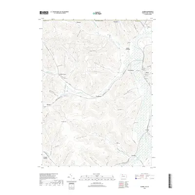
2019 Map of Eldred
USGS Topo · Published 2019About this map
The Allegheny River flows through the eastern reaches of this borderland, where the terrain of northern Pennsylvania meets the New York state line. The borough of Eldred serves as a local hub near the confluence of Knapp Creek and the river, anchored by landmarks like Saint Raphael Cem and Oak Hill Cem. To the west, the landscape is defined by deep incisions such as Windfall Hollow and Oil Valley, reflecting a history of natural resource extraction and rural settlement. The community of Duke Center sits along the Kansas Br, while Rixford occupies the high ground near Columbia Hill. This 2019 survey documents a complex network of hollows—including Beers Hollow and Moody Hollow—that have shaped the region's transport and genealogy for generations. The concentration of family and community burial grounds, such as Lamphier Cem and Stulltown Cem, provides vital points of reference for tracing local lineage in this river valley landscape.
Find a feature on this map
75 named features on this map. Tap any name to fly to it.
Don’t see what you’re looking for? This feature index may not catch every label — zoom into the map to look around manually.
Map Details
Editions of this 2019 Eldred Map
This is the sole edition of this map. No revisions or reprints were ever made.
Other maps of this area

1898 · Olean
USGS Topo · 1:62,500

1900 · Salamanca
USGS Topo · 1:62,500

1924 · Bradford
USGS Topo · 1:62,500

1926 · Bradford
USGS Topo · 1:62,500

1933 · Smethport
USGS Topo · 1:62,500

1937 · Smethport
USGS Topo · 1:62,500

1938 · Salamanca
USGS Topo · 1:62,500

1938 · Olean
USGS Topo · 1:62,500

1941 · Bradford
USGS Topo · 1:62,500

1943 · Olean
USGS Topo · 1:62,500