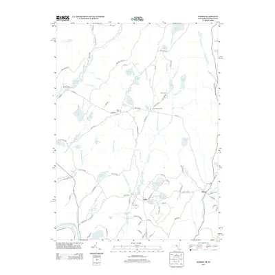
2013 Map of Eldred
USGS Topo · Published 2013About this map
Eldred and Yulan anchor this portrait of the Upper Delaware Valley, where water dominates the landscape across the New York-Pennsylvania border. The southwest corner is defined by the Delaware River and the nearby Pusten Mountain Lake, while a dense network of smaller bodies like Washington Lake, Bodine Lake, and Toasperns Pond sit nestled between local thoroughfares. For those studying the region's human history, the map includes sites like Saint Anthonys Cem and Beaver Brook Cem, alongside specialized locations such as Welmet Camps near Balsam Pond. The road network connects small crossroads like Beaver Brook Corners and Newieden, following older routes like the Old Cochecton Tpke. This topography reflects a transition from the riverbanks up into the lake-strewn hills of Pike and Sullivan counties.
Find a feature on this map
103 named features on this map. Tap any name to fly to it.
Don’t see what you’re looking for? This feature index may not catch every label — zoom into the map to look around manually.
Map Details
Editions of this 2013 Eldred Map
This is the sole edition of this map. No revisions or reprints were ever made.
Other maps of this area

1913 · Milford
USGS Topo · 1:62,500

1915 · Milford
USGS Topo · 1:62,500

1920 · Damascus
USGS Topo · 1:62,500

1922 · White Lake
USGS Topo · 1:62,500

1923 · Damascus
USGS Topo · 1:62,500

1935 · Hawley
USGS Topo · 1:62,500

1938 · Hawley
USGS Topo · 1:62,500

1942 · White Lake
USGS Topo · 1:62,500

1943 · Honesdale
USGS Topo · 1:125,000

1943 · White Lake
USGS Topo · 1:62,500