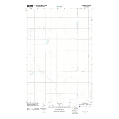
2011 Map of Eldridge SE
USGS Topo · Published 2011About this map
Beaver Creek meanders through the southern half of this landscape, carving a subtle path through the agricultural grid of Stutsman County. The area is defined by a strictly surveyed section-line road system, including thoroughfares like 38th St SE and 80th Ave SE, which facilitate travel across this open prairie region. Numerous small, scattered wetlands and ephemeral pools dot the terrain, particularly north of 40th St SE, illustrating the glacial potholes characteristic of the North Dakota plains. The lack of concentrated settlements or industrial sites emphasizes the rural, land-heavy nature of the quadrangle during this early 21st-century period, where the geometry of 77th Ave SE and 44th St SE frames a quiet, agrarian expanse.
Find a feature on this map
14 named features on this map. Tap any name to fly to it.
Don’t see what you’re looking for? This feature index may not catch every label — zoom into the map to look around manually.
Map Details
Editions of this 2011 Eldridge SE Map
This is the sole edition of this map. No revisions or reprints were ever made.
Other maps of this area

1896 · Jamestown
USGS Topo · 1:125,000

1951 · Jamestown
USGS Topo · 1:24,000

1951 · Eldridge SE
USGS Topo · 1:24,000

1951 · Eldridge NW
USGS Topo · 1:24,000

1952 · Eldridge
USGS Topo · 1:24,000

1952 · Homer
USGS Topo · 1:24,000

1952 · Jud NW
USGS Topo · 1:24,000

1952 · Eldridge SW
USGS Topo · 1:24,000

1953 · Jamestown
USGS Topo · 1:250,000

1953 · Montpelier NW
USGS Topo · 1:24,000