
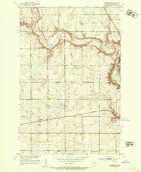
1952 Map of Eldridge
USGS Topo · Published 1952About this map
Pipestem Creek winds through this central North Dakota landscape, dramatically expanded by the waters of Lake Piestem following mid-century water management efforts in the Missouri River Basin. The settlement of Eldridge serves as a focal point along the Burlington Northern railroad line, which cuts an east-west path across the prairie. This 1952 survey, with revisions from 1975, captures a rural landscape defined by township blocks like Midway and Lippert.
Find a feature on this map
19 named features on this map. Tap any name to fly to it.
Don’t see what you’re looking for? This feature index may not catch every label — zoom into the map to look around manually.
Map Details
Editions of this 1952 Eldridge Map
2 editions found
Other maps of this area

1896 · Jamestown
USGS Topo · 1:125,000

1900 · Pingree
USGS Topo · 1:125,000

1900 · Pingree
USGS Topo · 1:62,500

1950 · Buchanan
USGS Topo · 1:24,000

1950 · Fried
USGS Topo · 1:24,000

1951 · Jamestown
USGS Topo · 1:24,000

1951 · Fried
USGS Topo · 1:24,000

1951 · Eldridge SE
USGS Topo · 1:24,000

1951 · Eldridge NW
USGS Topo · 1:24,000

1952 · Buchanan
USGS Topo · 1:24,000