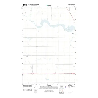
2011 Map of Eldridge
USGS Topo · Published 2011About this map
Pipestem Lake dominates the upper half of this North Dakota landscape, formed by the construction of Pipestem Dam on Pipestem Creek. The map documents a period when rural infrastructure in Stutsman County transitioned between traditional grid roads and modern thoroughfares, with the I94 Service Rd running parallel to the interstate corridor in the south. The small settlement of Eldridge is situated just north of this transit artery, serving as a focal point for local history along with the nearby Eldridge Cemetery. To the north, Minneapolis Flats Creek feeds into the primary waterway, while the community of Parkhurst sits at the edge of the lake. The survey captures the sparse but organized settlement patterns of the plains, where the section-line road network defines the movement of local residents and agricultural transport.
Find a feature on this map
26 named features on this map. Tap any name to fly to it.
Don’t see what you’re looking for? This feature index may not catch every label — zoom into the map to look around manually.
Map Details
Editions of this 2011 Eldridge Map
This is the sole edition of this map. No revisions or reprints were ever made.
Other maps of this area

1896 · Jamestown
USGS Topo · 1:125,000

1900 · Pingree
USGS Topo · 1:125,000

1900 · Pingree
USGS Topo · 1:62,500

1950 · Buchanan
USGS Topo · 1:24,000

1950 · Fried
USGS Topo · 1:24,000

1951 · Jamestown
USGS Topo · 1:24,000

1951 · Fried
USGS Topo · 1:24,000

1951 · Eldridge SE
USGS Topo · 1:24,000

1951 · Eldridge NW
USGS Topo · 1:24,000

1952 · Buchanan
USGS Topo · 1:24,000