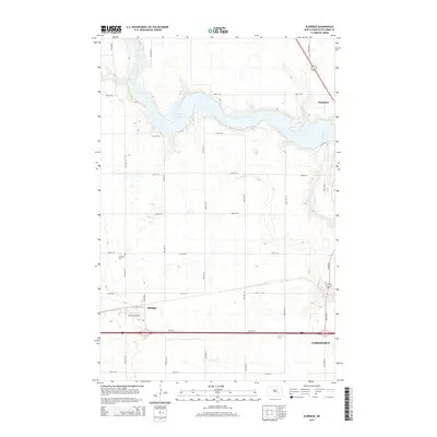
2014 Map of Eldridge
USGS Topo · Published 2014About this map
Pipestem Lake dominates the upper landscape of this 2014 survey, where the water is fed by Pipestem Cr as it flows toward the eastern edge of the quadrangle. The settlement of Eldridge is situated in the southwestern section, characterized by a grid of local roads and its proximity to the Eldridge Cem. Transportation and infrastructure are central to the area's layout, with a major interstate corridor cutting across the southern portion of the map, providing a direct link toward the western outskirts of Jamestown. Further north, the small settlement of Parkhurst sits near the lakeshore, while the Johnson Airstrip serves as a distinct aviation landmark south of the Eldridge townsite. This topography illustrates the intersection of North Dakota's agricultural prairie land with modern water management and transit networks.
Find a feature on this map
24 named features on this map. Tap any name to fly to it.
Don’t see what you’re looking for? This feature index may not catch every label — zoom into the map to look around manually.
Map Details
Editions of this 2014 Eldridge Map
This is the sole edition of this map. No revisions or reprints were ever made.
Other maps of this area

1896 · Jamestown
USGS Topo · 1:125,000

1900 · Pingree
USGS Topo · 1:125,000

1900 · Pingree
USGS Topo · 1:62,500

1950 · Buchanan
USGS Topo · 1:24,000

1950 · Fried
USGS Topo · 1:24,000

1951 · Jamestown
USGS Topo · 1:24,000

1951 · Fried
USGS Topo · 1:24,000

1951 · Eldridge SE
USGS Topo · 1:24,000

1951 · Eldridge NW
USGS Topo · 1:24,000

1952 · Buchanan
USGS Topo · 1:24,000