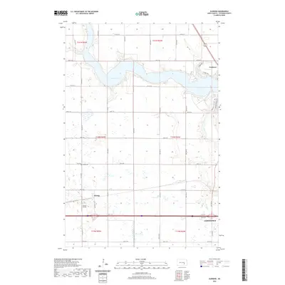
2020 Map of Eldridge
USGS Topo · Published 2020About this map
Pipestem Lake dominates the upper half of this prairie landscape, where its irregular northern shoreline meets a network of section-line roads. This modern survey illustrates the transition from the settlement at Eldridge to the western outskirts of Jamestown. Local history is anchored by the Eldridge Cem and the Johnson Airstrip, which sit amidst a terrain characterized by numerous small prairie potholes and wetlands. The drainage of Pipestem Cr provides a natural corridor for recreation, evidenced by the Pipestem Creek Trail and N Ridge Trail near Parkhurst. The map clearly shows the rectilinear grid of township and range lines that have defined North Dakota's agricultural development since the original land surveys.
Find a feature on this map
25 named features on this map. Tap any name to fly to it.
Don’t see what you’re looking for? This feature index may not catch every label — zoom into the map to look around manually.
Map Details
Editions of this 2020 Eldridge Map
This is the sole edition of this map. No revisions or reprints were ever made.
Other maps of this area

1896 · Jamestown
USGS Topo · 1:125,000

1900 · Pingree
USGS Topo · 1:125,000

1900 · Pingree
USGS Topo · 1:62,500

1950 · Buchanan
USGS Topo · 1:24,000

1950 · Fried
USGS Topo · 1:24,000

1951 · Jamestown
USGS Topo · 1:24,000

1951 · Fried
USGS Topo · 1:24,000

1951 · Eldridge SE
USGS Topo · 1:24,000

1951 · Eldridge NW
USGS Topo · 1:24,000

1952 · Buchanan
USGS Topo · 1:24,000