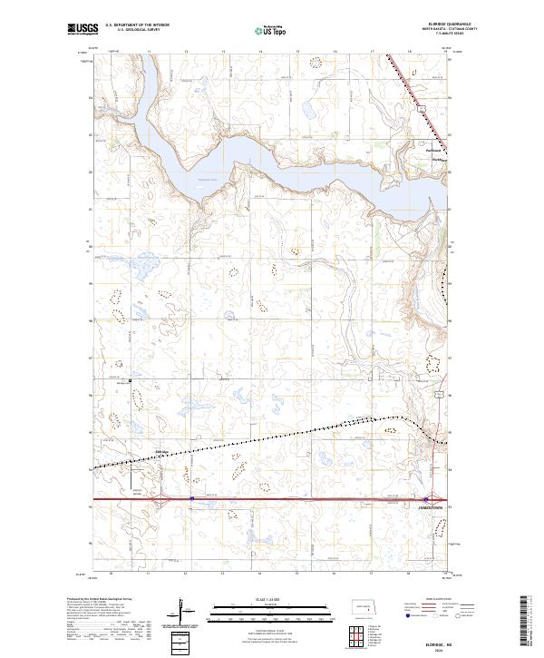
2024 Map of Eldridge
USGS Topo · Published 2024About this map
Pipestem Lake dominates the northern landscape of this Stutsman County region, serving as a focal point for the surrounding prairie terrain. The settlement of Eldridge is positioned south of the lake, characterized by its grid of local roads like 35th St SE and proximity to the Eldridge Cem. The map reveals a land divided by traditional township and range lines, including t140n r65w and t140n r64w, reflecting the enduring structure of North Dakota's rural geography. To the east, the edge of Jamestown enters the frame, while the Johnson Airstrip sits just south of Eldridge, indicating local aviation utility. Waterways such as Minneapolis Flats Creek and Pipestem Creek wind through the sections, highlighting the natural drainage patterns that have influenced agriculture and settlement in the area for generations.
Find a feature on this map
24 named features on this map. Tap any name to fly to it.
Don’t see what you’re looking for? This feature index may not catch every label — zoom into the map to look around manually.
Map Details
Editions of this 2024 Eldridge Map
This is the sole edition of this map. No revisions or reprints were ever made.
Other maps of this area

1896 · Jamestown
USGS Topo · 1:125,000

1900 · Pingree
USGS Topo · 1:125,000

1900 · Pingree
USGS Topo · 1:62,500

1950 · Buchanan
USGS Topo · 1:24,000

1950 · Fried
USGS Topo · 1:24,000

1951 · Jamestown
USGS Topo · 1:24,000

1951 · Fried
USGS Topo · 1:24,000

1951 · Eldridge SE
USGS Topo · 1:24,000

1951 · Eldridge NW
USGS Topo · 1:24,000

1952 · Buchanan
USGS Topo · 1:24,000