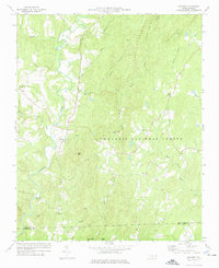
1973 Map of Eleazer
USGS Topo · Published 1976About this map
Eleazer and Abner anchor the southern reaches of Randolph County in this 1970s topographical record. The landscape is defined by the high ridges of the Uwharrie Mountains, including Coolers Knob Mountain and King Mtn, which separate the drainage of the Uwharrie River to the west from the Little River system to the east. Large portions of the terrain are preserved within the Uwharrie National Forest, though the presence of numerous small churches and cemeteries speaks to the deep-rooted rural communities that persist among the peaks.
Find a feature on this map
41 named features on this map. Tap any name to fly to it.
Don’t see what you’re looking for? This feature index may not catch every label — zoom into the map to look around manually.
Map Details
Editions of this 1973 Eleazer Map
This is the sole edition of this map. No revisions or reprints were ever made.
Other maps of this area

1942 · Troy
USGS Topo · 1:125,000

1953 · Raleigh
USGS Topo · 1:250,000

1953 · Charlotte
USGS Topo · 1:250,000

1954 · Charlotte
USGS Topo · 1:250,000

1954 · Raleigh
USGS Topo · 1:250,000

1957 · Albemarle
USGS Topo · 1:62,500

1957 · Denton
USGS Topo · 1:62,500

1957 · Troy
USGS Topo · 1:62,500

1957 · Asheboro
USGS Topo · 1:62,500

1960 · Charlotte
USGS Topo · 1:250,000