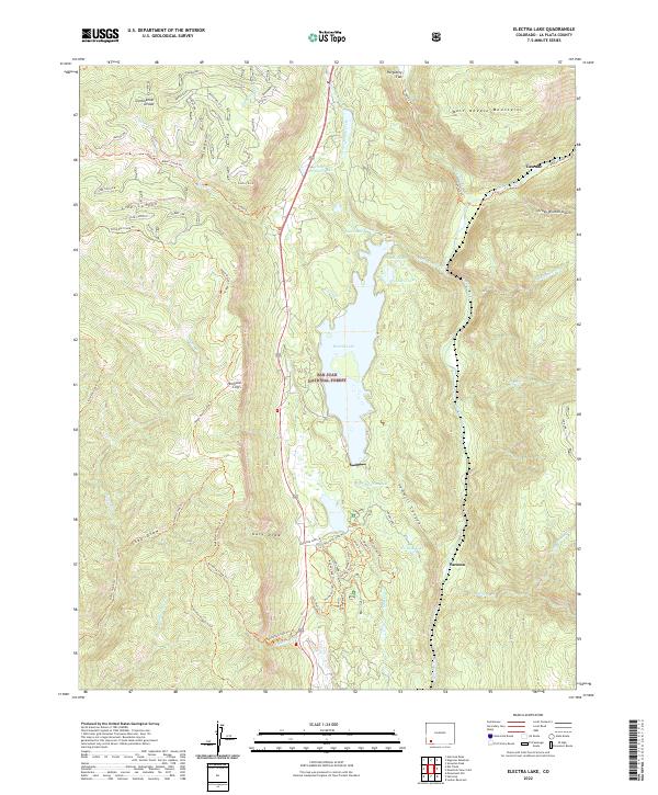
2022 Map of Electra Lake
USGS Topo · Published 2022About this map
Electra Lake serves as the central focal point of this high-elevation landscape within the San Juan National Forest, where steep vertical relief is defined by the Hermosa Cliffs and the West Needle Mountains. The terrain is deeply incised by canyons and draws, including Sawmill Canyon and Stag Draw, which feed a complex network of creeks such as Elbert Cr and Little Cascade Creek.
Find a feature on this map
57 named features on this map. Tap any name to fly to it.
Don’t see what you’re looking for? This feature index may not catch every label — zoom into the map to look around manually.
Map Details
Editions of this 2022 Electra Lake Map
This is the sole edition of this map. No revisions or reprints were ever made.
Other maps of this area

1898 · Durango
USGS Topo · 1:62,500

1898 · Engineer Mountain
USGS Topo · 1:62,500

1900 · Engineer Mountain
USGS Topo · 1:62,500

1900 · Needle Mountains
USGS Topo · 1:62,500

1902 · Needle Mountains
USGS Topo · 1:62,500

1907 · Durango
USGS Topo · 1:62,500

1908 · Engineer Mountain
USGS Topo · 1:62,500

1908 · Ignacio
USGS Topo · 1:125,000

1908 · Durango
USGS Topo · 1:62,500

1924 · Ignacio
USGS Topo · 1:125,000