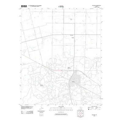
2010 Map of Electra
USGS Topo · Published 2010About this map
Electra serves as the primary hub of this North Texas landscape, where the gridded streets of the town transition into a network of ranch roads and water management systems. To the north, the small community of Haynesville and the Mount Carmel Cemetery provide specific points of interest for genealogists tracing local families. The geography is defined by an intricate drainage system including China Creek, Buffalo Creek, and several forks of Bluff and Sunflower Creeks, which feed into essential water infrastructure.
Find a feature on this map
37 named features on this map. Tap any name to fly to it.
Don’t see what you’re looking for? This feature index may not catch every label — zoom into the map to look around manually.
Map Details
Editions of this 2010 Electra Map
This is the sole edition of this map. No revisions or reprints were ever made.
Other maps of this area

1915 · Barwise School
USGS Topo · 1:24,000

1916 · Electra
USGS Topo · 1:24,000

1916 · Fowlkes
USGS Topo · 1:24,000

1917 · Beaver Creek
USGS Topo · 1:24,000

1918 · Electra
USGS Topo · 1:31,680

1918 · Barwise School
USGS Topo · 1:31,680

1919 · Fowlkes
USGS Topo · 1:31,680

1920 · Beaver Creek
USGS Topo · 1:31,680

1954 · Wichita Falls
USGS Topo · 1:250,000

1955 · Lawton
USGS Topo · 1:250,000