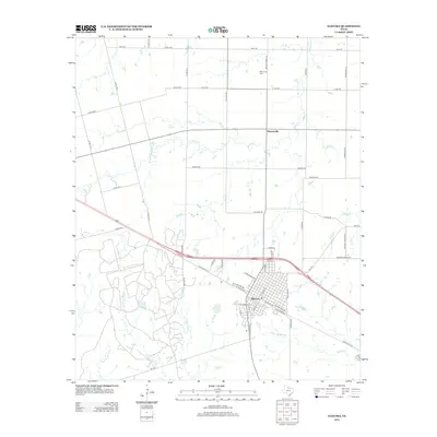
2012 Map of Electra
USGS Topo · Published 2012About this map
Electra serves as the focal point of this North Texas survey, showcasing a grid of streets such as N Main St, W Michigan Ave, and E Railroad Ave. The landscape to the north is characterized by a sprawling network of county roads and water features, including the notable China Springs and the meandering China Cr. These drainages, along with Buffalo Cr and the various branches of W Fork Bluff Cr, define the cattle and oil country of Wichita County.
Find a feature on this map
56 named features on this map. Tap any name to fly to it.
Don’t see what you’re looking for? This feature index may not catch every label — zoom into the map to look around manually.
Map Details
Editions of this 2012 Electra Map
This is the sole edition of this map. No revisions or reprints were ever made.
Other maps of this area

1915 · Barwise School
USGS Topo · 1:24,000

1916 · Electra
USGS Topo · 1:24,000

1916 · Fowlkes
USGS Topo · 1:24,000

1917 · Beaver Creek
USGS Topo · 1:24,000

1918 · Electra
USGS Topo · 1:31,680

1918 · Barwise School
USGS Topo · 1:31,680

1919 · Fowlkes
USGS Topo · 1:31,680

1920 · Beaver Creek
USGS Topo · 1:31,680

1954 · Wichita Falls
USGS Topo · 1:250,000

1955 · Lawton
USGS Topo · 1:250,000