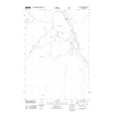
2011 Map of Electric Peak
USGS Topo · Published 2011About this map
Corwin Springs and the settlement of Electric sit along the banks of the Yellowstone River as it winds through this portion of Park County. The landscape is defined by dramatic geological features such as the Devils Slide and the towering Electric Peak near the Montana-Wyoming border. Evidence of local history and genealogy is preserved at the Aldridge Cemetery near Aldridge Lake and the Horr Cemetery located further south. The map documents the northern fringe of Yellowstone National Park, where the river corridor facilitates access through routes like the Old Yellowstone Trl S. This area serves as a significant gateway to the park's wilderness, marked by educational institutions like Summit University and recreational spots like the LaDuke Spring Campground. The numerous drainages, including Reese Creek and Mulherin Creek, reveal the complex watershed draining from the high peaks into the valley bottom.
Find a feature on this map
31 named features on this map. Tap any name to fly to it.
Don’t see what you’re looking for? This feature index may not catch every label — zoom into the map to look around manually.
Map Details
Editions of this 2011 Electric Peak Map
This is the sole edition of this map. No revisions or reprints were ever made.
Other maps of this area

1885 · Gallatin
USGS Topo · 1:125,000

1885 · Gallatin
USGS Topo · 1:125,000

1891 · Livingston
USGS Topo · 1:250,000

1893 · Livingston
USGS Topo · 1:250,000

1901 · Gallatin
USGS Topo · 1:125,000

1908 · Gallatin
USGS Topo · 1:125,000

1911 · Gallatin
USGS Topo · 1:125,000

1947 · Bozeman
USGS Topo · 1:250,000

1948 · Bozeman
USGS Topo · 1:250,000

1955 · Bozeman
USGS Topo · 1:250,000