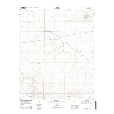
2014 Map of Elephant Butte
USGS Topo · Published 2014About this map
Elephant Butte stands as the primary landmark in this high-desert landscape, located within the Navajo County portion of the Fort Defiance Agency. This 2014 survey documents a terrain defined by dramatic geological transitions, notably the Edge Of Mesa and the expansive Ives Mesa. The drainage patterns of the region are clearly traced through seasonal watercourses like Bird Springs Wash, Coyote Wash, and Johns Draw, which have carved deep impressions into the arid soil. Transportation across this sparsely populated area is facilitated by Bureau of Indian Affairs routes, including Bia-15, Bia-9843, and Bia-9846, which connect the scattered mesa tops and valley floors. The map provides a detailed view of the township and range divisions, showing the intersection of several sections including T23N R17E and T22N R16E.
Find a feature on this map
15 named features on this map. Tap any name to fly to it.
Don’t see what you’re looking for? This feature index may not catch every label — zoom into the map to look around manually.
Map Details
Editions of this 2014 Elephant Butte Map
This is the sole edition of this map. No revisions or reprints were ever made.
Other maps of this area

1883 · Tusayan
USGS Topo · 1:250,000

1886 · Tusayan
USGS Topo · 1:250,000

1947 · Flagstaff
USGS Topo · 1:250,000

1954 · Winslow
USGS Topo · 1:62,500

1954 · Winslow 4 NW
USGS Topo · 1:24,000

1954 · Winslow 4 NE
USGS Topo · 1:24,000

1954 · Flagstaff
USGS Topo · 1:250,000

1957 · Winslow 1 SW
USGS Topo · 1:24,000

1958 · Flagstaff
USGS Topo · 1:250,000

1960 · Flagstaff
USGS Topo · 1:250,000