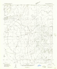
1957 Map of Winslow 1 SW
USGS Topo · Published 1957About this map
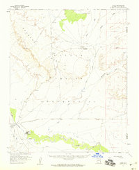
The Navajo Indian Reservation landscape is defined by vast drainage networks and scattered water sources in this mid-century survey. Arid geography dictates the locations of infrastructure here, as seen in the several instances of Stock Tank and a lonely Windmill positioned to support livestock. The terrain is marked by the prominent Ives Mesa in the southeast and the winding course of the Whe-yol-da-sah Wash.
Find a feature on this map
18 named features on this map. Tap any name to fly to it.
Don’t see what you’re looking for? This feature index may not catch every label — zoom into the map to look around manually.
Map Details
Editions of this 1957 Winslow 1 SW Map
This is the sole edition of this map. No revisions or reprints were ever made.
Other maps of this area

1883 · Tusayan
USGS Topo · 1:250,000

1886 · Tusayan
USGS Topo · 1:250,000

1947 · Flagstaff
USGS Topo · 1:250,000
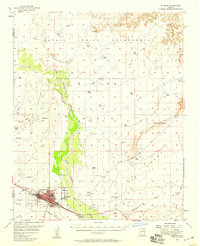
1954 · Winslow
USGS Topo · 1:62,500
1954 · Winslow 4 NW
USGS Topo · 1:24,000
1954 · Winslow 4 NE
USGS Topo · 1:24,000

1954 · Flagstaff
USGS Topo · 1:250,000
1955 · Leupp
USGS Topo · 1:62,500
1957 · Winslow 2 SE
USGS Topo · 1:24,000

1958 · Flagstaff
USGS Topo · 1:250,000