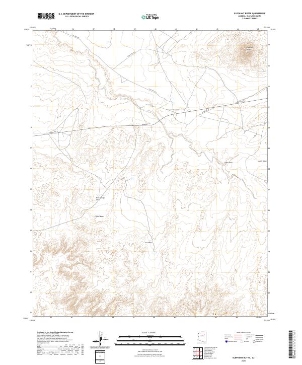
2021 Map of Elephant Butte
USGS Topo · Published 2021About this map
Elephant Butte rises above the high desert of Navajo County, serving as the primary landmark for this sparsely developed landscape. The terrain is defined by the broad expanse of Ives Mesa and the complex drainage systems that carve through the plateau. Watercourses like Bird Springs Wash, Coyote Wash, and Johns Draw illustrate the natural runoff patterns of the region, where seasonal flows have shaped the earth over centuries. Human presence is marked by a network of tribal roads, including Indian Rte 15, Indian Rte 9843, and Indian Rte 9846, which provide the essential transit corridors across these open ranges. This 2021 update from the U.S. Geological Survey offers a clear view of the modern boundaries and infrastructure within the Navajo Nation.
Find a feature on this map
14 named features on this map. Tap any name to fly to it.
Don’t see what you’re looking for? This feature index may not catch every label — zoom into the map to look around manually.
Map Details
Editions of this 2021 Elephant Butte Map
This is the sole edition of this map. No revisions or reprints were ever made.
Other maps of this area

1883 · Tusayan
USGS Topo · 1:250,000

1886 · Tusayan
USGS Topo · 1:250,000

1947 · Flagstaff
USGS Topo · 1:250,000

1954 · Winslow
USGS Topo · 1:62,500

1954 · Winslow 4 NW
USGS Topo · 1:24,000

1954 · Winslow 4 NE
USGS Topo · 1:24,000

1954 · Flagstaff
USGS Topo · 1:250,000

1957 · Winslow 1 SW
USGS Topo · 1:24,000

1958 · Flagstaff
USGS Topo · 1:250,000

1960 · Flagstaff
USGS Topo · 1:250,000