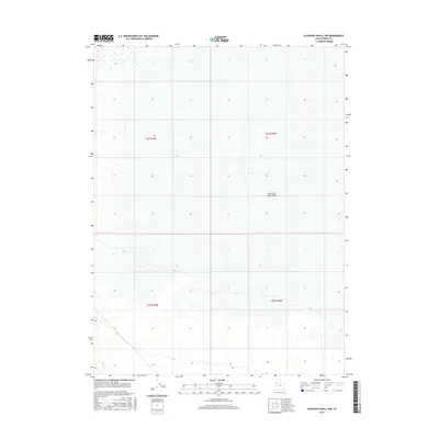
2017 Map of Elephant Knoll NW
USGS Topo · Published 2017About this map
Great Salt Lake Desert dominates this quadrant of Tooele County, presenting a landscape defined by the expansive salt crust and minimal topographic variation typical of this basin. The map illustrates the systematic organization of the Public Land Survey System, specifically within the boundaries of t4s r19w, t4s r18w, t5s r19w, and t5s r18w. The lack of named settlements or infrastructure highlights the isolation of this corner of the Great Basin, where subtle contour lines and wetland markers from the FWS National Wetlands Inventory indicate a delicate hydrological environment that contrasts with the surrounding arid flats.
Find a feature on this map
5 named features on this map. Tap any name to fly to it.
Don’t see what you’re looking for? This feature index may not catch every label — zoom into the map to look around manually.
Map Details
Editions of this 2017 Elephant Knoll NW Map
This is the sole edition of this map. No revisions or reprints were ever made.
Other maps of this area

1953 · Tooele
USGS Topo · 1:250,000

1955 · Tooele
USGS Topo · 1:250,000

1955 · Elko
USGS Topo · 1:250,000

1958 · Elko
USGS Topo · 1:250,000

1962 · Elko
USGS Topo · 1:250,000

1965 · Elko
USGS Topo · 1:250,000

1972 · Ferguson Flat
USGS Topo · 1:24,000

1972 · Utah Peak
USGS Topo · 1:24,000

1972 · Elephant Knoll
USGS Topo · 1:24,000
1972 · Wendover SE
USGS Topo · 1:24,000