
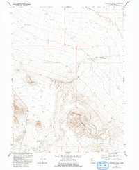
1972 Map of Elephant Knoll
USGS Topo · Published 1975About this map
Elephant Knoll and the surrounding high desert of western Tooele County are depicted here through 1970s photogrammetric surveying. The landscape is defined by the Ferber Hills to the west and the prominent heights of Red Mountain to the southeast. Human activity in this arid basin is evidenced by several water management features, including Oswald Reservoir and JB Reservoir, which likely supported the nearby Last Chance Ranch.
Find a feature on this map
18 named features on this map. Tap any name to fly to it.
Don’t see what you’re looking for? This feature index may not catch every label — zoom into the map to look around manually.
Map Details
Editions of this 1972 Elephant Knoll Map
2 editions found
Other maps of this area

1925 · Gold Hill
USGS Topo · 1:62,500

1928 · Gold Hill
USGS Topo · 1:62,500

1953 · Tooele
USGS Topo · 1:250,000

1955 · Tooele
USGS Topo · 1:250,000

1955 · Elko
USGS Topo · 1:250,000

1958 · Elko
USGS Topo · 1:250,000

1962 · Elko
USGS Topo · 1:250,000

1965 · Elko
USGS Topo · 1:250,000

1972 · Ferguson Flat
USGS Topo · 1:24,000

1972 · Utah Peak
USGS Topo · 1:24,000