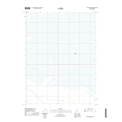
2020 Map of Elephant Knoll NW
USGS Topo · Published 2020About this map
Great Salt Lake Desert dominates this expansive landscape within Tooele County, reflecting a vast and austere environment where the alkaline flats define the topography. This 2020 survey illustrates the transition from the high salt flats to the subtle elevation changes of the desert floor, with contours tracing the ancient lakebed's margins. The map captures a moment of modern stillness in an area historically defined by its harsh geography and the challenges it posed to westward expansion. While the terrain appears mostly featureless, the precise mapping of wetland boundaries and subtle hydrography reveals the complex nature of this arid basin. This document serves as a detailed record for understanding the environmental shifts and topographic nuances of this specific section of the western desert.
Find a feature on this map
1 named feature on this map. Tap any name to fly to it.
Don’t see what you’re looking for? This feature index may not catch every label — zoom into the map to look around manually.
Map Details
Editions of this 2020 Elephant Knoll NW Map
This is the sole edition of this map. No revisions or reprints were ever made.
Other maps of this area

1953 · Tooele
USGS Topo · 1:250,000

1955 · Tooele
USGS Topo · 1:250,000

1955 · Elko
USGS Topo · 1:250,000

1958 · Elko
USGS Topo · 1:250,000

1962 · Elko
USGS Topo · 1:250,000

1965 · Elko
USGS Topo · 1:250,000

1972 · Ferguson Flat
USGS Topo · 1:24,000

1972 · Utah Peak
USGS Topo · 1:24,000

1972 · Elephant Knoll
USGS Topo · 1:24,000
1972 · Wendover SE
USGS Topo · 1:24,000