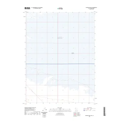
2023 Map of Elephant Knoll NW
USGS Topo · Published 2023About this map
The Great Salt Lake Desert dominates this Tooele County landscape, where the white expanse of the salt flats meets a highly controlled military environment. The vast majority of this terrain is part of the Utah Test and Training Range, a restricted area used for defense operations. The map illustrates a stark, arid geography defined more by its openness and lack of permanent settlement than by structural landmarks. Subtle topographic contours reveal the slight elevations of the desert floor, showing how the salt basin transitions between dry flats and seasonal wetlands. This survey provides an essential view of one of the most secluded and regulated corridors in the Great Basin, capturing the intersection of natural salt crust features and modern military land management.
Find a feature on this map
3 named features on this map. Tap any name to fly to it.
Don’t see what you’re looking for? This feature index may not catch every label — zoom into the map to look around manually.
Map Details
Editions of this 2023 Elephant Knoll NW Map
This is the sole edition of this map. No revisions or reprints were ever made.
Other maps of this area

1953 · Tooele
USGS Topo · 1:250,000

1955 · Tooele
USGS Topo · 1:250,000

1955 · Elko
USGS Topo · 1:250,000

1958 · Elko
USGS Topo · 1:250,000

1962 · Elko
USGS Topo · 1:250,000

1965 · Elko
USGS Topo · 1:250,000

1972 · Ferguson Flat
USGS Topo · 1:24,000

1972 · Utah Peak
USGS Topo · 1:24,000

1972 · Elephant Knoll
USGS Topo · 1:24,000
1972 · Wendover SE
USGS Topo · 1:24,000