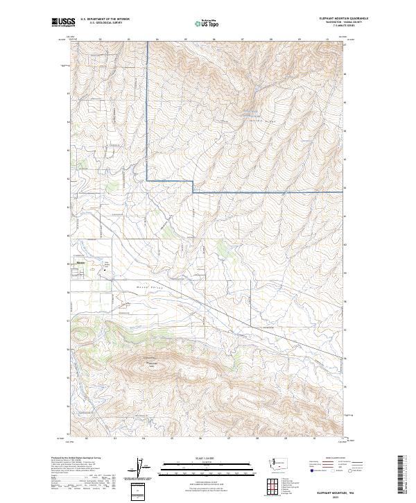
2023 Map of Elephant Mountain
USGS Topo · Published 2023About this map
The irrigated floor of Moxee Valley is the focal point of this Yakima County landscape, where the agricultural community of Moxee thrives beneath the surrounding heights. Life here is defined by water management, with the Roza Canal and Selah Moxee Irrigation Canal cutting across the terrain to sustain the valley. To the north, the topographic relief rises sharply into Yakima Ridge and Kittitas Canyon, a portion of which is occupied by Joint Base Lewis-McChord. Local history is anchored by the Holy Rosary Cem near the town center, while the southern horizon is dominated by the prominent peaks of Elephant Mtn and the Rattlesnake Hills. The grid of rural roads, such as Desmarais Rd and Beane Rd, reflects the organized division of this high-desert farming region.
Find a feature on this map
47 named features on this map. Tap any name to fly to it.
Don’t see what you’re looking for? This feature index may not catch every label — zoom into the map to look around manually.
Map Details
Editions of this 2023 Elephant Mountain Map
This is the sole edition of this map. No revisions or reprints were ever made.
Other maps of this area

1910 · Zillah
USGS Topo · 1:125,000

1936 · Yakima East
USGS Topo · 1:48,000

1936 · Hog Ranch Buttes
USGS Topo · 1:48,000

1941 · Black Rock Spring
USGS Topo · 1:62,500

1941 · Yakima East
USGS Topo · 1:62,500

1950 · Yakima
USGS Topo · 1:250,000
1953 · Black Rock Spring NW
USGS Topo · 1:24,000

1953 · Pomona
USGS Topo · 1:24,000
1953 · Black Rock Spring SW
USGS Topo · 1:24,000

1953 · Elephant Mountain
USGS Topo · 1:24,000